CISAT and the Power of GIS
CGU partnership with geographic information systems pioneer Esri creates the perfect place for opportunity
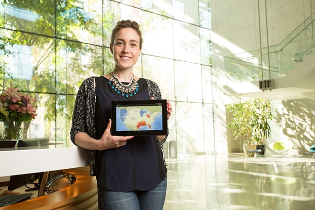
Lauren Bennett is a product engineer for Esri, the Redlands, Calif.-based global leader in geographic information systems (GIS) software. When she enrolled in a PhD program at CGU—just 30 miles west of her office—location mattered. It wasn’t just the short distance to the campus that made location matter: location has always mattered to her, maybe more than the average person because Bennett has a passion for geography.
“It’s about the real world and solving real problems, whether it is surveying land and understanding how land-use changes impact the environment or understanding how diseases impact our government spending,” she said.
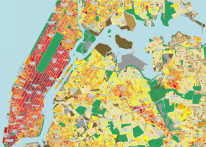
GIS technology integrates hardware, software, and data for analyzing and displaying information to reveal patterns and trends through maps, computer models, reports, and charts. Esri’s GIS applications have been used to pinpoint crime rates in Philadelphia, track landmines in Kosovo, and rebuild infrastructure in Afghanistan. CGU faculty and students have used Esri tools to assist relief efforts in Haiti and Japan.
Working for Esri, the preeminent GIS pioneer, recently prompted Bennett to broaden her education and technical reach. Through a comprehensive new CGU partnership with Esri, she received a scholarship and enrolled in the information systems and technology doctoral program at the university’s Center for Information Systems & Technology (CISAT). Bennett was attracted to the transdisciplinary environment where she could strengthen her research skills and bring benefits to her company.
The new opportunities created by CGU and Esri place Bennett in a cutting-edge partnership where GIS technology and the new frontier of location analytics are used to save lives and make communities safer, governments smarter, and businesses more effective.
“It’s really interesting how GIS can affect our future because it cuts across all industries and many decisions people are trying to make,” Bennett said.
CGU will offer Bennett that opportunity to change our world.
“To me, learning more about the philosophy of information systems here at CGU and how information systems are approached from a business and societal perspective is giving me a lot of insight,” she said. “It is helping me understand the future of GIS because it is closely linked with how information systems are guiding business, government, and nonprofits.”
Bennett has traveled to Malaysia, Denmark, Poland, France, Chile, and other countries to promote the value of using GIS solutions to tackle local, national, and international issues. Location analytics is considered the next phase in GIS solutions, and combines geographic information with data on an organization’s operations to shed insight and drive decision-making.
“Location analytics helps companies make better decisions about their business,” she said. “It helps police departments make better decisions about keeping their citizens safe. It helps public health departments make better decisions about keeping their citizens healthy.”
As an undergraduate and as a graduate student, Bennett had many first-hand experiences with the power of GIS. Motivated by the concept of “food deserts”—areas, often in inner cities and poor rural areas where fresh, healthy food is scarce, and processed, unhealthy food is plentiful—Bennett conducted a spatial analysis of obesity rates and their underlying factors in Los Angeles County for her master’s thesis.
“Food deserts are a spatial problem,” Bennett said. “People don’t have access to fresh fruits and vegetables, so how do we expect them to eat healthy? Unfortunately, those are often the populations that are the most vulnerable, too. Often they are residents with lower incomes who work multiple jobs or single-parent households with less access to vehicles. So not only do they have less access to supermarkets or grocery stores that sell fresh fruits and vegetables, they are economically constrained in their choices.
This spatial approach is fundamental to Esri’s philosophy. It was a match to Bennett’s plans for her own future.
When Bennett joined Esri, she became part of a growing company that today has 3,000 employees, 11 regional US offices, and more than 80 distributors outside the United States.
Esri’s history goes back to 1960, when Esri founder Jack Dangermond and his wife, Laura (both CGU honorary degree recipients), founded Environmental Systems Research Institute, Inc. Originally, the company offered ways to organize and analyze geographic information to help urban planning professionals make informed decisions about environmental and development policies. By the 1970s, Esri had created its first GIS system for San Diego County. Later, it emerged as a global company through establishing ties with similar firms in Canada, Germany, and Australia.
Esri software aided recovery efforts in New York City and the Pentagon following the 9/11 attacks. Its applications have assisted nonprofits, governments, and public agencies battling the aftereffects of wildfires, hurricanes, floods, earthquakes, and tsunamis.
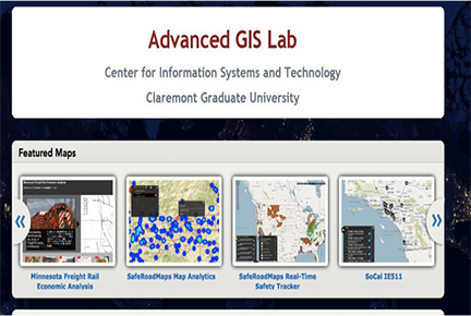
In 2008, the firm selected CISAT to serve as the base for one of the company’s inaugural Esri Development Centers (EDCs). The center provides faculty and students with access to Esri applications and training through the university’s Advanced GIS Lab.
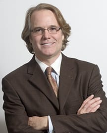
“GIS has grown from an application generally suited to geography and urban planning into a platform that informs almost every aspect of human endeavor,” said Tom Horan, CISAT director and CGU faculty member. “It is being used to inform public health entities about disease outbreaks, businesses about new markets and services, and governments about citizen trends and opinions. As such, it is a preeminent transdisciplinary tool.”
This was evident when CISAT faculty member Brian Hilton and his students used the Esri EDC to develop GIS tools for disaster preparedness and responses in a partnership with World Vision International, a faith-based NGO. Hilton and his students created comprehensive maps in the wake of the 2010 earthquake in Haiti that showed the location of cholera-treatment centers and clean-water sources along with detailed and accurate routes for reaching them. Maps by Hilton and his students were also used to help with relief efforts in Japan after the tsunami and nuclear power plant crises of 2011.
The Esri/CGU collaboration also led to a unique project tackling driving safety. With the University of Minnesota, CISAT’s EDC helped to create SafeRoadMaps, an online application that provides highly detailed traffic-safety maps and data for the public. The website generated more than 12 million visits so far, according to Horan, research director for the project. Hilton directed this project’s architectural, technical, and GIS development.
CGU and Esri recently entered into a new phase of their relationship with a multi-year agreement signed last year that bolsters each organization’s education, research, and training goals. The new comprehensive partnership will expand Esri’s engagement with CISAT to include the Peter F. Drucker & Masatoshi Ito Graduate School of Management and the Institute of Mathematical Sciences. The School of Educational Studies has also begun several GIS studies using GIS resources at CGU.
“This partnership places CGU at the leading edge of one of the most exciting areas of technological innovation—namely, geo-spatial technologies and location analytics,” Horan said. “Through collaborative scholarships and research, CGU is working with Esri to create and evaluate new GIS applications in areas such as health, transportation, business, and education. The potential for making positive changes both locally and globally is enormous.”
Through the agreement, Esri and CGU will provide up to ten scholarships per year for qualified Esri employees, like Bennett, who meet the university’s academic and admissions standards. The company will also offer CGU students summer internship and the opportunity to attend the Esri International User Conference. In its continuing work with CISAT’s Advanced GIS Lab in the fields of business, health, and transportation as they relate to spatial analytics, Esri will provide the university with beta versions of software for testing and experienced Esri staff as guest lecturers.
“One of the great advantages of CGU as a small university is we can do these GIS and location analyses in a transdisciplinary way,” Horan said. “We can bring together the technologists, social scientists, the students studying business or public health, and study issues in a holistic manner.”
Bennett said she is looking forward to enhancing her future at Esri because of her CGU experience and training.
“I am fortunate that Esri and CGU have formed this partnership to give me an opportunity to pursue the highest level of graduate education, while at the same time preparing me to contribute to new advances in GIS,” she said. “I know I’m in just the right place, the perfect location you might say, to make a real impact!”